The coast
West Beach · The Mesa · Carpinteria
Explore coastal living →The American Riviera · 34.4208° N
A considered guide to finding your place—whether you’re here for a long weekend or a lifetime.
Build my neighborhood shortlist →Santa Barbara Harbor · Original editorial artwork
01 · Find your corner
From salt-air mornings on the Mesa to oak-shaded afternoons in Montecito, every pocket has its own rhythm. Start with the life you want to live.
West Beach · The Mesa · Carpinteria
Explore coastal living →Downtown · San Roque · The Riviera
Find your neighborhood →Montecito · Hope Ranch · Goleta
See homes with space →02 · The complete coastal corridor
Six distinct stops form the lived-in Santa Barbara coast. Explore them east to west, then continue beyond Goleta into the state beaches of the Gaviota Coast.
A compact beach city with a walkable core, gentle shoreline, bluffs, and a distinctly small-town rhythm.
Linden Avenue · Carpinteria State Beach · salt marshExplore Carpinteria →A hillside village where antique shops, cafés, and ocean views gather along a short stretch of coast.
Lookout Park · Lillie Avenue · hillside lanesExplore Summerland →Garden estates, two village centers, mountain trailheads, and beaches tucked beneath a leafy residential canopy.
Coast Village Road · Upper Village · Butterfly BeachExplore Montecito →The region’s cultural and civic center, stretching from waterfront neighborhoods to foothill enclaves and canyon roads.
State Street · harbor · Mission · 32 city neighborhoodsExplore Santa Barbara →A transition of estate roads, beach access, schools, shopping, and unincorporated neighborhoods before Goleta proper.
More Mesa · Hendry’s Beach · eastern Goleta ValleyExplore Hope Ranch & Noleta →Family neighborhoods, technology campuses, open spaces, UCSB energy, and quick access to the wider Gaviota Coast.
Old Town · Lake Los Carneros · Ellwood MesaExplore Goleta →State Street · Santa Barbara’s civic spine
State Street is more than a shopping corridor. Its cross streets connect Chumash homeland, Spanish and Mexican-era adobes, American commerce, theater history, earthquake reconstruction, and one of California’s most recognizable revival-style cityscapes.
The downtown corridor stands within the ancestral homeland of Chumash peoples, whose communities, trade, knowledge, and stewardship long predate the street and the city.
Spain founded the Santa Barbara Presidio in 1782. Adobe homes and civic life grew around the fort during Spanish and Mexican rule.
State Street developed into the commercial spine of a growing California town, joined by hotels, shops, theaters, streetcars, and new rail connections.
The June 29 earthquake damaged much of downtown. Reconstruction accelerated a coordinated Spanish Colonial Revival identity that still defines the corridor.
Santa Barbara created its Old Town historic district and adopted protections for its architectural character and surviving adobe structures.
Eight central blocks closed to vehicle traffic during the pandemic. The City’s long-range State Street planning process now considers the corridor’s next chapter.
Santa Barbara contains genuine Spanish- and Mexican-era adobe history, but much of downtown’s unified appearance is later. After the 1925 earthquake, civic leaders, architects, property owners, and preservation advocates embraced Spanish Colonial and Mediterranean Revival design for reconstruction. The result is both history and a deliberate twentieth-century city-making project.
Read the City’s history overview ↗Historic buildings & origins
Walk south to north through downtown and nearby cross streets. Each building reveals a different layer: Indigenous labor and continuity, colonial government, Californio family life, immigrant enterprise, civic rebuilding, and the rise of mass entertainment.
The last Spanish presidio founded in Alta California. Two original adobe buildings—El Cuartel and the Cañedo Adobe—survive within the State Historic Park.
Official history ↗Built with Chumash labor for the Presidio comandante, trader, and landowner. The house became a center of civic ceremony, hospitality, and early Californio life.
Official history ↗Founded in 1873 and rebuilt in 1924 by George Washington Smith and Lutah Maria Riggs, the Lobero is California’s oldest continuously operating theater.
Official history ↗The former downtown post office was adapted as an art museum and opened to the public in 1941—civic architecture finding a lasting cultural second life.
Official history ↗Built as an ambitious entertainment complex and opened just before the 1925 earthquake, which it survived. Warner Bros. later operated it as a movie palace.
Official history ↗Designed after the 1925 earthquake, its tile, ironwork, murals, arches, and Moorish details helped establish the architectural language of rebuilt Santa Barbara.
Official history ↗Built on the site of the earthquake-damaged Arlington Hotel. Its atmospheric auditorium evokes an outdoor Spanish village beneath a starry ceiling.
Official history ↗The last remaining building of Santa Barbara’s historic Chinatown, preserving the story of Chinese immigrant enterprise and community life downtown.
Official history ↗Art without a ticket
Santa Barbara’s public art ranges from iconic permanent sculpture to community murals, playable pianos, painted pavement, civic interiors, and temporary work that changes the experience of State Street.
A stack of vivid geometric planes frames mountain, sky, palms, and passing traffic near East Beach—part color theory, part coastal gateway.
Cabrillo Boulevard at Calle Puerto VallartaLearn more ↗The leaping dolphins at the foot of Stearns Wharf have become an informal emblem of the waterfront and a meeting point for generations of visitors.
Entrance to Stearns WharfLearn more ↗An Oaxacan-inspired design turns crosswalks and curb extensions into a large civic canvas while supporting pedestrian visibility and traffic calming.
State and Carrillo streetsLearn more ↗Purpose-built pads allow contemporary sculpture to enter the historic streetscape. The works rotate, so repeat visitors may encounter an entirely different street.
Along the State Street corridorLearn more ↗Each autumn, artist-painted pianos transform the street into an open stage where professionals, students, and passersby share the same instrument.
Changing downtown locationsLearn more ↗A small public garden designed with four anchored sculpture pads, lighting, and power for changing installations in the civic heart of town.
21 E. Anapamu StreetLearn more ↗Murals created from the 1970s onward hold deep neighborhood significance. Current park planning treats their history, condition, and future interpretation as essential community questions.
Ortega ParkLearn more ↗Panoramic imagery presents a romanticized account of regional history inside the 1929 courthouse. Read it both as spectacle and as a product of its own era’s selective storytelling.
Santa Barbara County CourthouseLearn more ↗Three ways to follow the work
Chromatic Gate → East Beach → Dolphin Family → Stearns Wharf
Best in clear morning light or late afternoon.Carrillo asphalt art → sculpture pads → painted pianos in season → Jardín de las Granadas
Confirm rotating installations on the County art map.Ortega Park → El Presidio area → Courthouse Mural Room → Channing Peake Gallery
Pair visual impact with historical context and community voices.For foggy mornings & curious afternoons
These institutions make the coast legible—from deep natural history and marine ecology to visual art, technology, maritime work, and the competing stories people tell about the past.
A former post office transformed into galleries spanning Asian, American, and European art, with changing exhibitions in the center of downtown.
Plan a visit ↗More than 3.5 million specimens, a planetarium, regional anthropology and geology, and 17 acres of oak woodland along Mission Creek.
Plan a visit ↗A compact, hands-on window into Channel life—sharks, rays, sea stars, jellies, oceanographic tools, and working marine-conservation stories.
Plan a visit ↗Commercial fishing, diving, surfing, Channel crossings, lighthouse history, and the people who have made lives from the sea.
Plan a visit ↗Three floors of playful science, technology, engineering, art, and mathematics near the train station—especially strong for families and makers.
Plan a visit ↗Collections and exhibitions that connect the city’s Indigenous, Spanish, Mexican, American, family, and civic histories.
Plan a visit ↗03 · City of Santa Barbara neighborhood atlas
These names follow the City of Santa Barbara’s current GIS neighborhood layer. They are city designations—not a substitute for parcel boundaries, zoning, school districts, or local usage.
Open the City’s mapping resources ↗04 · Beyond Goleta
El Capitán and Refugio are the signature state beaches west of Goleta; Gaviota State Park completes the connected planning area. Always check California State Parks for current hours, closures, fees, and reservations before setting out.
A creek-cut coastal park with bluff-top camping, beach access, sycamores, and long views across the channel.
Day use · camping · beach · coastal trailA palm-lined cove known for picnics, swimming, fishing, sunsets, and an intimate campground close to the water.
8am–sunset · camping · picnic · swimmingThe rugged continuation: a pier-and-canyon landscape with hiking routes and a much wilder sense of the coast.
Day use · camping · hiking · fishingA year of local traditions
Fruit harvests, performance, heritage, and wine shape the regional calendar. Timing changes from year to year—use the official event link before making travel plans.
A joyful, handmade parade and multi-day festival centered on Alameda Park—the region’s great expression of eccentric, participatory creativity.
Official festival ↗A citywide tradition founded in 1924, with performances, community gatherings, food, and processions. Approach its romantic imagery alongside the region’s fuller Indigenous, Mexican, and immigrant histories.
Official festival ↗A three-day celebration that began with Solvang’s 25th anniversary in 1936 and continues to honor the town’s Danish-American roots.
Official festival ↗A free Girsh Park weekend celebrating Goleta’s agricultural heritage with local businesses, food, entertainment, and family activities.
Official festival ↗Three days of music, food, growers, arts, and nonprofit booths in downtown Carpinteria—built around the crop most associated with the valley.
Official festival ↗The original county wine festival gathers dozens of wineries and the people behind them for a broad tasting of Santa Barbara wine country.
Official festival ↗Over the mountains
Santa Barbara is both a coastal destination and the southern door to a completely different landscape: oak savanna, ranches, Danish-American Solvang, small-town Santa Ynez, walkable Los Olivos, and vineyards shaped by striking microclimates.
Coast → San Marcos Pass → Lake Cachuma → Santa Ynez ValleyState Route 154 climbs from Santa Barbara over the Santa Ynez Mountains, opening broad views before descending toward Lake Cachuma and the valley.
Check Caltrans before every tripPlan this stop ↗A compact community of ranch heritage, restaurants, tasting rooms, and nearby equestrian landscapes at the eastern heart of the valley.
Good base for Happy CanyonPlan this stop ↗Historic streets, galleries, restaurants, and an unusually dense collection of tasting rooms, with vineyard roads spreading in every direction.
Park once; appoint a driverPlan this stop ↗Museums, bakeries, architecture, shops, lodging, and easy access to vineyards make Solvang the valley’s most recognizable visitor hub.
Stay overnight to slow the dayPlan this stop ↗A practical western base with restaurants, breweries, lodging, and access toward the Sta. Rita Hills and Highway 101.
Gateway to cool-climate winePlan this stop ↗A reservoir recreation area between the coast and valley offering broad landscapes, camping, picnicking, and a change of pace from tasting rooms.
No body-contact recreationPlan this stop ↗A simple wine compass
Cooler, wind-influenced country west of Buellton, especially associated with Pinot Noir and Chardonnay.
A warmer north–south canyon between Buellton and Los Olivos, strongly associated with Rhône varieties.
Broad alluvial terraces around Los Olivos with varied grapes and easy access to town tasting rooms.
The warmer eastern edge of the valley, known especially for Bordeaux varieties and expansive ranch landscapes.
The landscape on a plate
Santa Barbara food is not one cuisine. It is a conversation between ocean, orchards, farms, vineyards, migration, labor, tourism, and neighborhood traditions.
Lemons once helped define Goleta’s agricultural identity; the annual Lemon Festival keeps that history visible even as the city has changed.
Warm slopes and a protected coastal climate support avocado orchards, celebrated downtown each October with music, food, and growers.
Local fishing history includes lobster, crab, sea urchin, rockfish, and other seasonal catches. Ask what is local today rather than assuming.
Weekly certified markets bring growers directly into Carpinteria, Montecito, Santa Barbara, Goleta, and Solvang throughout the week.
Ocean influence, transverse valleys, varied soils, elevation, and heat create sharply different growing conditions within a short drive.
Mexican, Chumash, Mediterranean, Asian-American, European, ranching, and contemporary California traditions all contribute to the region’s food story.
The weekly market rhythm
Market locations and hours can change, but the pattern connects the whole region: downtown Santa Barbara, Old Town, Montecito, Carpinteria, Goleta, and Solvang. Go early for selection; go later for conversation and a slower pace.
Check the official market schedule ↗From promenade to chaparral
Distance alone does not describe a Santa Barbara outing. Sun, heat, marine fog, steep terrain, poison oak, wildfire restrictions, parking, water, and shared trail use can change the experience.
Link East Beach, Stearns Wharf, the harbor, Leadbetter Beach, and Shoreline Park in flexible sections.
Coastal Vista Trail segments offer island views, birding, whale watching, and a distant seal overlook. Respect closures and sensitive habitat.
A shaded frontcountry route connecting into a larger trail network. Dogs must be leashed; bikes are not permitted.
A popular city-and-islands overlook reached from the Tunnel Trail system. Expect shared use and limited trailhead parking.
Broad grasslands, eucalyptus groves, and bluff-top routes create a spacious western counterpart to Santa Barbara’s urban waterfront.
The main trail climbs nearly four miles toward Gibraltar Road. Heat, fire conditions, water, navigation, and turnaround time matter.
Look closer
The best local facts change how a place looks: an island becomes an evolutionary laboratory, a tree becomes a civic monument, and a garden reveals the improbable life of its creator.
Cold and warm currents meet around the Channel Islands. The national park’s small footprint contains biological diversity associated with nearly 1,000 miles of the West Coast.
Explore the island ecosystem ↗The world’s largest animals migrate into the Santa Barbara Channel to feed on krill. NOAA identifies the channel as both vital whale habitat and a busy shipping corridor.
Learn about whales & ships ↗Santa Barbara’s Moreton Bay fig was planted in 1876. Its trunk measures roughly 38 feet around, making it one of the largest examples of its species in the nation.
Visit the city tree park ↗Opera singer and visionary Ganna Walska shaped Lotusland for more than four decades—and sold part of her jewelry collection to keep building her botanical world.
Discover Lotusland ↗The Santa Barbara Zoo occupies the former Child Estate, once called Vegamar. Community fundraising transformed the seaside property into a zoo that opened in 1963.
Read the zoo’s story ↗Around the islands, kelp forests create layered habitat for fish, invertebrates, marine mammals, and seabirds—an underwater counterpart to a forest on land.
Enter the marine sanctuary ↗Chumash crews continue the open-ocean crossing to Limuw, Santa Cruz Island, in a traditional plank canoe—a living expression of knowledge, relationship, and continuity.
Explore Channel Islands heritage ↗Italian stone pines, pepper trees, figs, sycamores, and rare specimens mark different eras of settlement, horticulture, civic design, and preservation across the city.
See the landmark-tree list ↗Small missions for curious people
Find three different kinds of decorative tile downtown—and notice where each one appears.
Watch the islands change as marine haze lifts, then return at sunset when their silhouettes sharpen.
Compare the temperature at the waterfront, downtown, and the foothills on the same afternoon.
Choose one historic building and identify what is original, reconstructed, adapted, or revival-era.
Spend ten quiet minutes at a creek, wetland, kelp overlook, or oak woodland and list every species you notice.
The shoreline, east to west
Use this as an orientation guide, then verify parking, access, tides, water quality, closures, and dog rules before departure.
Broad access from downtown Carpinteria; check tides and seasonal conditions.
A bluff-top neighborhood park with paths down toward the shoreline.
Limited roadside parking; arrive respectfully and leave room for residents.
Close to the waterfront, zoo, rentals, and Cabrillo Boulevard path.
A convenient sandy cove beside Shoreline Park and the harbor.
Also known as Hendry’s; observe posted dog-zone and creek-water guidance.
Near the airport and UCSB, with lawns and a long shoreline setting.
Reserve ahead for camping and confirm current operating conditions.
Dogs are allowed in campground and day-use areas, but not on the beach.
How the city fits together
The City recognizes 32 individual neighborhoods. These editorial groups make the larger pattern easier to understand while preserving the official names in the atlas above.
Best for beach access, cycling, harbor activity, visitor energy, and marine air. Compare parking, tourism patterns, and coastal exposure block by block.
The most walkable part of the city, with restaurants, culture, transit, and mixed housing. Street life and noise can change quickly across a few blocks.
Established residential pockets near daily services, schools, hospitals, and cross-town routes. These areas reward a street-level visit rather than a drive-through.
Convenient shopping and quieter residential streets rise toward the foothills. Pay attention to heat, slope, wildfire context, and distance from Highway 101.
Architecture, mature landscaping, and elevated views define the east side. Hillside roads, insurance, drainage, and access deserve careful review.
Residential ridges and canyons above the coast, often close to open space and ocean outlooks. Test wind, fog, topography, and access at different times.
A coast that looks shorter than it feels
The routines behind the scenery
Santa Barbara’s quality of life is also practical: a growing bicycle network, a concentrated performing-arts district, and a broad mix of public and independent education options. These are best compared through ordinary weekday routines—not reputation alone.
The City maintains an interactive bicycle-network map, public bike parking, electric-assist bike share, and secure downtown Bike Spot facilities. The waterfront and downtown are natural starting points, while comfort can change quickly with traffic, hills, construction, and the type of bike facility.
The Granada, the Lobero, and Ensemble Theatre Company at the New Vic sit within Santa Barbara’s Historic Theatre District. Together they support touring productions, resident arts organizations, professional theater, music, dance, film, lectures, and community performance.
03 · Education landscape
Greater Santa Barbara includes multiple public districts plus independent, faith-based, boarding, and day-school options. The guide does not rank schools or connect school choice to who should live in a neighborhood. Families should compare current programs, admissions, tuition or assistance, transportation, calendars, student support, and personal fit directly with each school.
Santa Barbara County district overview ↗05 · Read the market
Figures are illustrative snapshots, not live listings. Local conditions change quickly—use them to orient, then verify with a licensed professional.
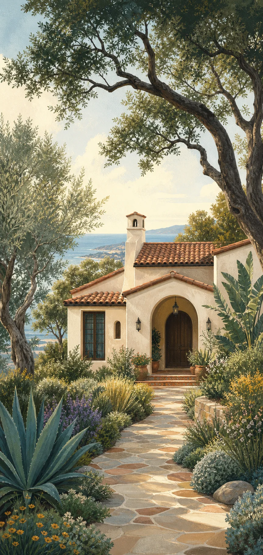
Estate living · garden calm
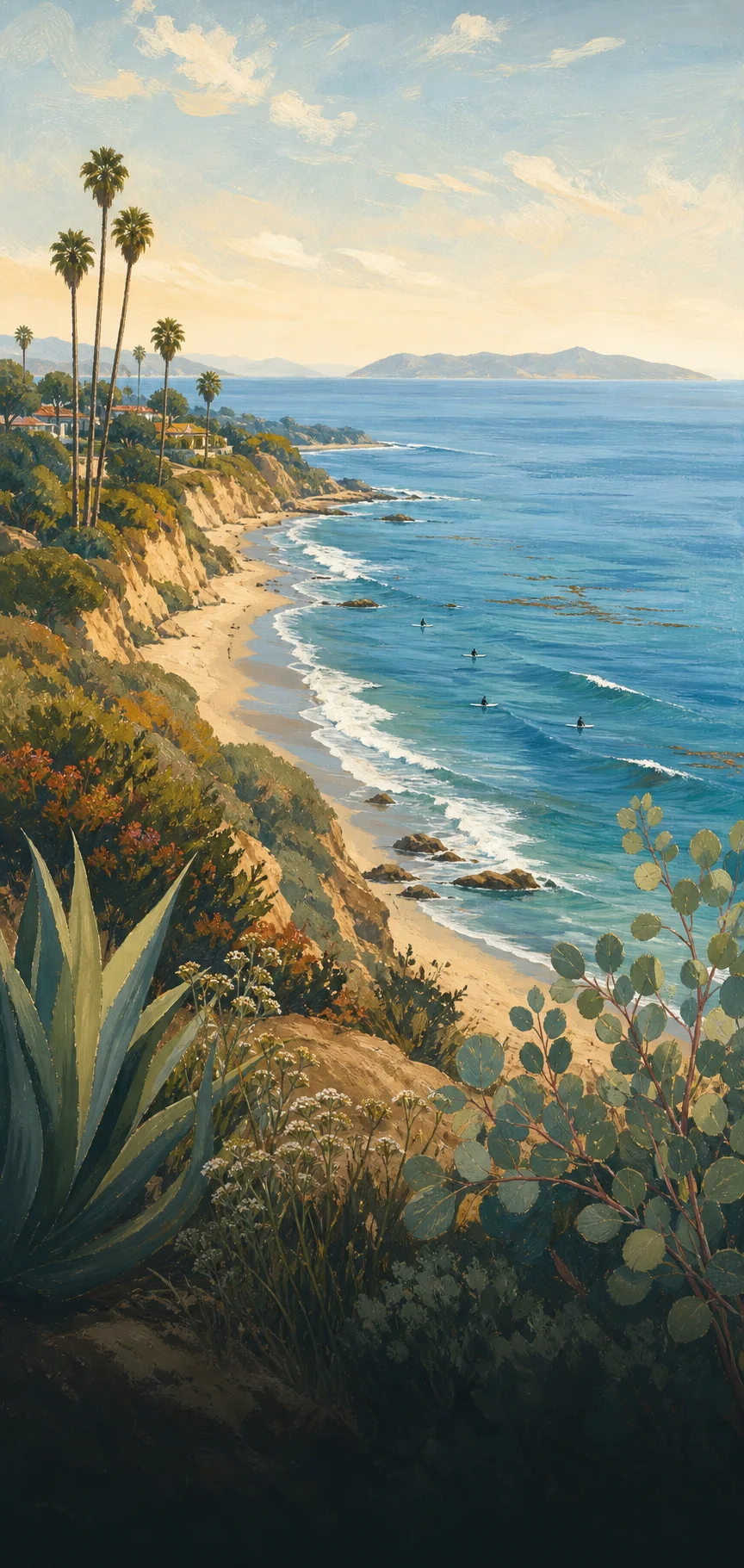
Ocean views · easy beach days
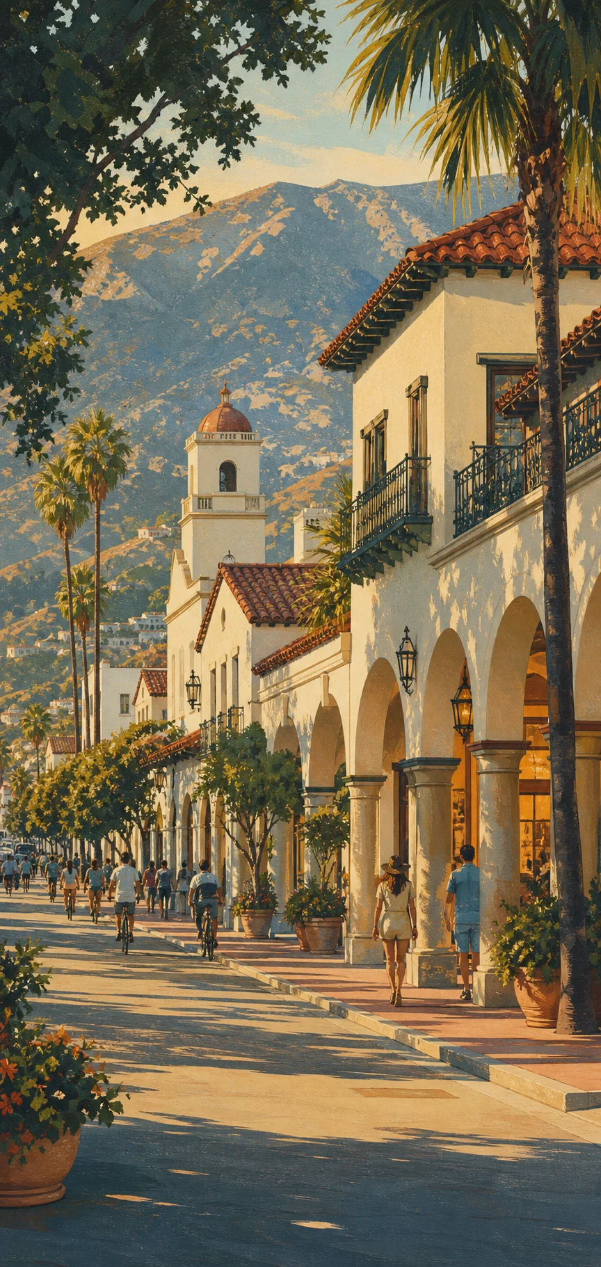
Walkable · Spanish character
A clearer next step
Share what you are considering and receive a focused starting point for the Santa Barbara coast—neighborhoods to compare, questions to ask, and the next useful conversation.
Before the open house
A beautiful address is only the beginning. Santa Barbara rewards buyers who understand the parcel, the microclimate, and the rhythm of daily life.
Visit at school-run time and after dark. Listen for road noise, notice parking, and test the route you would actually use.
Ask about drainage, slope, defensible space, coastal exposure, and the maintenance story behind mature gardens.
Model taxes, insurance, utilities, upkeep, commuting, and renovation—not just the purchase price.
Use local professionals and primary records for current inventory, permits, hazards, boundaries, and neighborhood rules.
04 · Build your own day
A flat shoreline walk when the light is soft and the tide is kind.
Coffee, galleries, tasting rooms, and seafood within an easy wander.
Choose a foothill route for chaparral scent and island views.
Oak valleys, farm stands, and tasting rooms less than an hour away.
03 · Make a weekend of it
A loose itinerary for first-timers, designed around golden hours, good tables, and very little windshield time.
Start at the harbor, wander the Funk Zone, then settle in for sunset at Leadbetter Beach.
Mission roses, Riviera overlooks, and a slow afternoon among Montecito’s leafy lanes.
Take San Marcos Pass toward Los Olivos for tasting rooms, oak-lined roads, and golden hills.
The practical details
Spring brings wildflowers; fall offers the warmest water. Even winter days are often made for a long walk.
Downtown rewards walking. A car makes beach towns, trailheads, and wine country easier to fold into the day.
Compare microclimates, commute patterns, insurance, and parcel-level risks before falling for the view.
05 · Relocation field notes
Before choosing a neighborhood, spend one ordinary weekday living the version of Santa Barbara you imagine.
Book a few nights in the area, not at the resort you already know.
Test school, work, grocery, beach, and airport routes at real times.
Talk with a local agent, insurer, lender, inspector, and land-use professional as relevant.
The right neighborhood may be the one you had not considered.
The year in four moods
Garden color, green hills, and soft afternoons.
Marine mornings that often open into bright evenings.
Clear coastlines and golden wine-country drives.
Storm watching, crisp views, and room to wander.
06 · Good questions
Yes, but the experience changes by neighborhood. Coastal fog, foothill heat, tourist seasons, commute patterns, and insurance considerations all deserve a real-world test before you commit.
A note from the coast
Important disclosures
Content is provided for general educational, editorial, and informational purposes. It is not legal, tax, accounting, investment, insurance, lending, appraisal, engineering, environmental, land-use, title, inspection, medical, safety, or other professional advice. Nothing on this site creates an agency, fiduciary, brokerage, advisory, or professional-client relationship.
Prices, “typical entry” figures, market observations, neighborhood descriptions, maps, boundaries, property characteristics, availability, and other real-estate references are illustrative and may be incomplete, approximate, outdated, or subject to change without notice. They are not live listings, offers, appraisals, comparative market analyses, guarantees, or predictions of value or performance. Verify all material facts through qualified, appropriately licensed professionals and primary records before acting.
Users should independently investigate permits, zoning, lawful use, square footage, lot lines, title, easements, schools, utilities, taxes, assessments, insurance availability and cost, financing, HOA obligations, coastal rules, wildfire and flood hazards, environmental conditions, seismic risk, drainage, access, and any other matter important to a purchase, sale, lease, or investment. Photographs and editorial descriptions may not depict current conditions.
Hours, access, fees, reservations, road and trail conditions, transit, weather, tides, water quality, wildfire conditions, closures, parking, pet rules, event dates, and business operations can change. Consult the responsible agency, venue, organizer, or business before departure. Outdoor and coastal activities involve inherent risks; use personal judgment and follow posted warnings and closures.
External links are offered for convenience and source orientation. The guide does not control, endorse, warrant, or assume responsibility for third-party content, availability, privacy practices, products, services, or transactions. A link does not imply sponsorship, affiliation, or approval.
Housing opportunities should be available without unlawful discrimination. This guide supports the principles of the federal Fair Housing Act and applicable California fair-housing laws. Neighborhood content describes places and physical characteristics, not the protected characteristics of residents or who should live there. If you encounter a barrier using this site, submit an accessibility request through the contact form.
To the fullest extent permitted by law, use of this site and reliance on its content are at your own risk. The guide is provided “as is” without warranties of completeness, accuracy, availability, fitness for a particular purpose, or non-infringement. This disclosure is a general website notice and should be reviewed by qualified California counsel and the responsible licensed real-estate professional before the site is used for regulated advertising or brokerage activity.